
Kentucky Map
|
 |
 |
Where Is Kentucky?
Looking at the map to the right, you can see Kentucky highlighted in red. The Commonwealth of Kentucky is bounded by Indiana on the north, by Tennessee on the south, by West Virginia on the east, and by Missouri on the west. It is bounded by Ohio on the northeast, by Virginia on the southeast, and by Illinois on the northwest.
Kentucky Maps
Kentucky is the 36th largest state in the United States, and its land area is 39,728 square miles (102,896 square kilometers). Kentucky is subdivided into 120 counties. This Kentucky map site features road maps, topographical maps, and relief maps of Kentucky. The detailed, scrollable road map displays Kentucky counties, cities, and towns as well as Interstate, U.S., and Kentucky state highways. The pannable, scalable Kentucky street map can be zoomed in to show local streets and detailed imagery.
Kentucky Highway Map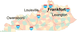 Click on the highway map thumbnail
to view a scalable Kentucky road map. |
KY Topo Map Click map to enlarge.
|
KY Relief Map Click map to enlarge.
|
The detailed Kentucky map and the regional Kentucky map display cities, roads, rivers, and lakes as well as terrain features. The detailed map shows only the Commonwealth of Kentucky, while the regional map shows Kentucky and the surrounding region.
Kentucky Infrastructure > Kentucky Airports
In 2005, the population of Kentucky was estimated at 4,172,608, which is about 105.0 people per square mile. In 2010, Kentucky's population rose to 4,339,367 people. More recently, in the 2020 census, the Kentucky population was 4,505,836. The state's Interstate Highways include I-24, I-64, I-65, I-71, and I-75.
Kentucky Topography and Attractions
The name Kentucky may be derived from the Iroquois word "ken-tah-ten", which means "land of tomorrow" or from the Iroquois word for "prairie". Much of Kentucky consists of rolling plains drained by the Ohio, Kentucky, and Tennessee Rivers. The Pine Mountains in southeastern Kentucky overlook the Cumberland plateau region. Tourist attractions in Kentucky include Mammoth Cave, Cumberland Gap National Historic Park, and the Abraham Lincoln Birthplace National Historic Site. For more Kentucky travel and tourism information, visit the official Kentucky tourism site and Kentucky Atlas.
Other Kentucky Maps
This online Kentucky reference map shows major cities, roads, railroads, and physical features in Kentucky.Several map publishing companies offer printed maps of Kentucky. For example, Omni Resources offers several maps of Kentucky that feature points of interest, airports, and parks, as well as selected local attractions and insets of major Kentucky cities.
All rights reserved.
Certain maps hereon are © Map Resources or Digital Wisdom.
To facilitate browsing, certain external links will open in new windows.
Kentucky-Map.org Editor, State Maps, PO Box 828, Barnegat, NJ 08005.